Project Maps

Projects

Maps

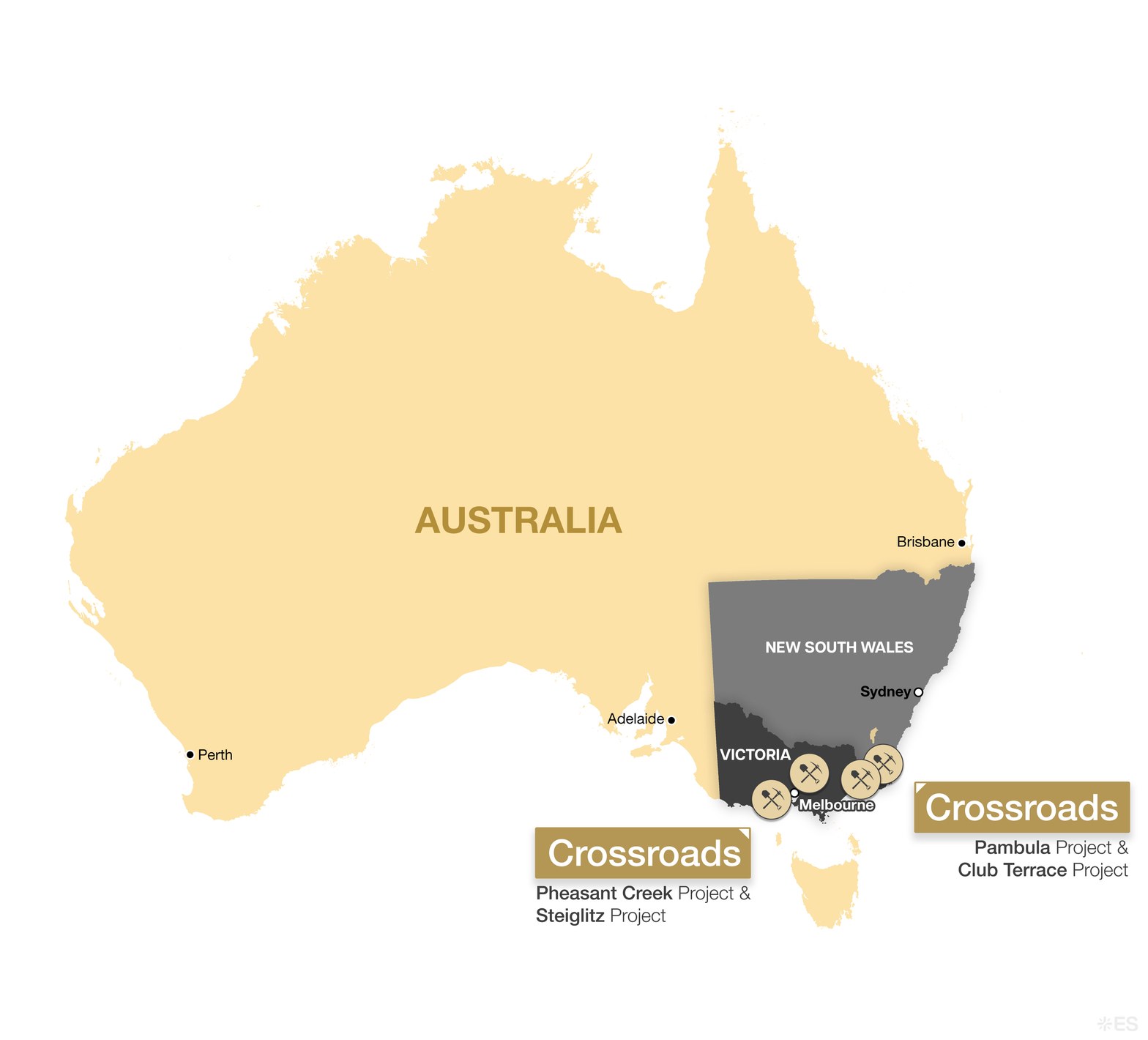
Map of Australia with Victoria and New South Wales highlighted, marking Crossroads’ Pheasant Creek and Steiglitz Projects near Melbourne and its Pambula and Club Terrace Projects near the Victoria–New South Wales border, with Perth, Adelaide, Melbourne, Sydney and Brisbane labelled

Figure 1: Australia Locator Map

Crossroads’ Pheasant Creek, Steiglitz, Pambula and Club Terrace Projects in Victoria and New South Wales.
View full size →
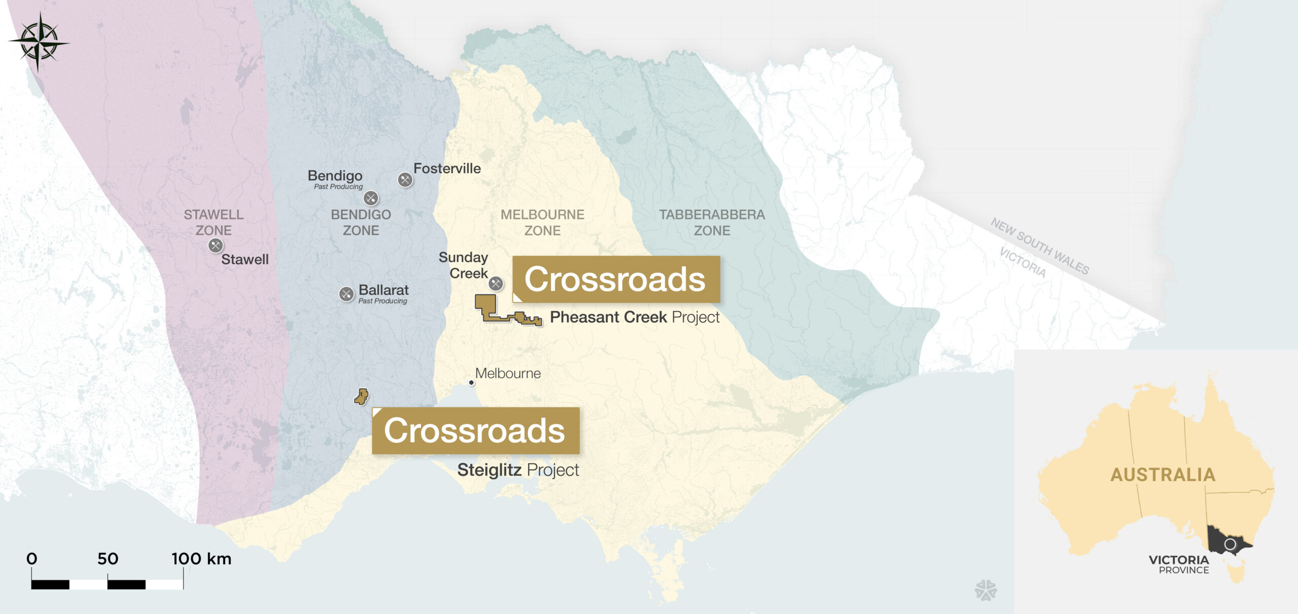
Map of Victoria showing the Stawell, Bendigo, Melbourne and Tabberabbera geological zones, with Crossroads’ Pheasant Creek Project just south of Sunday Creek and the Steiglitz Project south-west of Melbourne, plus Bendigo, Ballarat, Fosterville and Stawell, an Australia locator inset and a 100 km scale bar

Figure 2: Victorian Geological Zones Map

Pheasant Creek and Steiglitz Projects in relation to the Stawell, Bendigo, Melbourne and Tabberabbera Zones.
View full size →
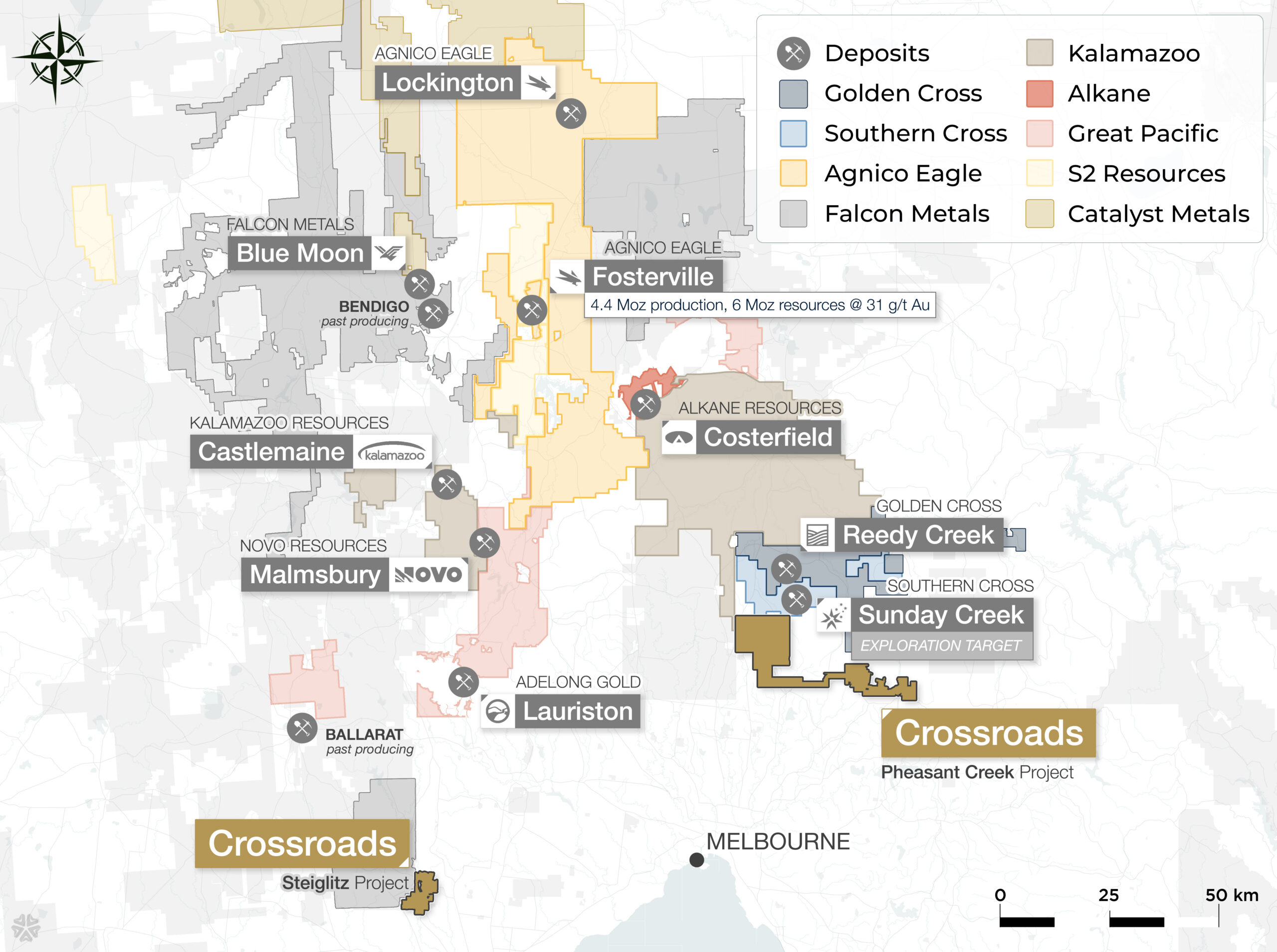
Regional claims map of central Victoria showing Crossroads’ Pheasant Creek Project next to Sunday Creek and Reedy Creek and the Steiglitz Project south of Ballarat, with neighbouring claims and deposits including Fosterville, Lockington, Costerfield, Blue Moon, Castlemaine, Malmsbury and Lauriston, a claim-holder legend and a 50 km scale bar

Figure 3: Regional Claims Map – Pheasant Creek & Steiglitz

Pheasant Creek and Steiglitz Projects in relation to neighbouring claim holders and deposits across central Victoria.
View full size →
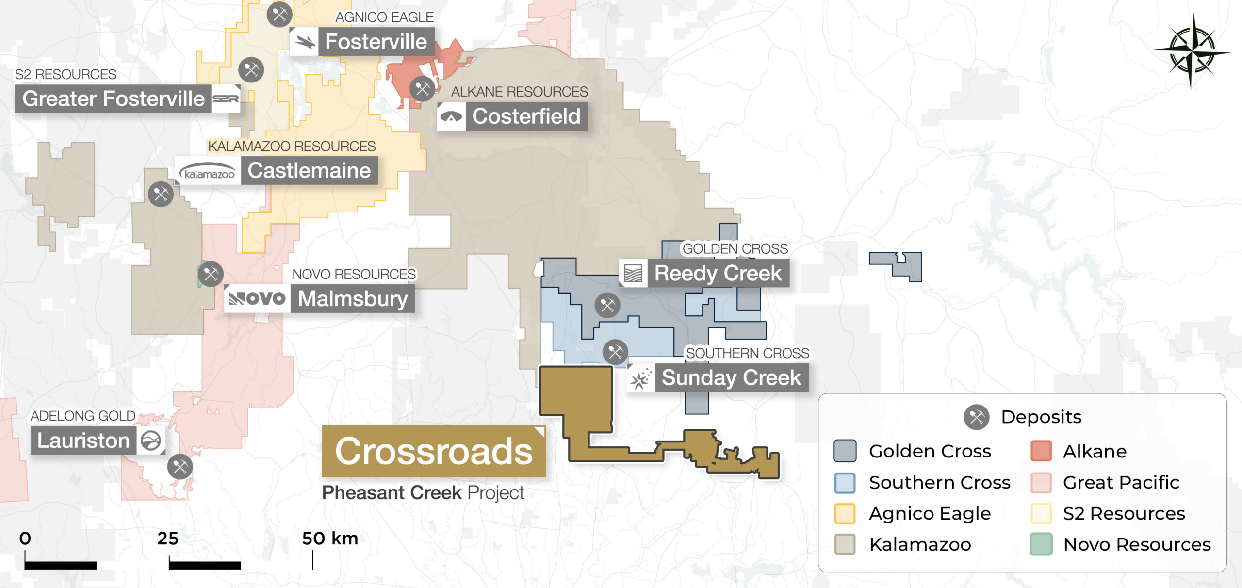
Close-up claims map showing Crossroads’ Pheasant Creek Project directly south of Southern Cross’ Sunday Creek and Golden Cross’ Reedy Creek, with Costerfield, Fosterville, Greater Fosterville, Castlemaine, Malmsbury and Lauriston to the north and west, a claim-holder legend and a 50 km scale bar

Figure 4: Pheasant Creek Area Claims Map

Closer view of the Pheasant Creek Project and neighbouring claims, including Sunday Creek, Reedy Creek, Costerfield and Fosterville.
View full size →
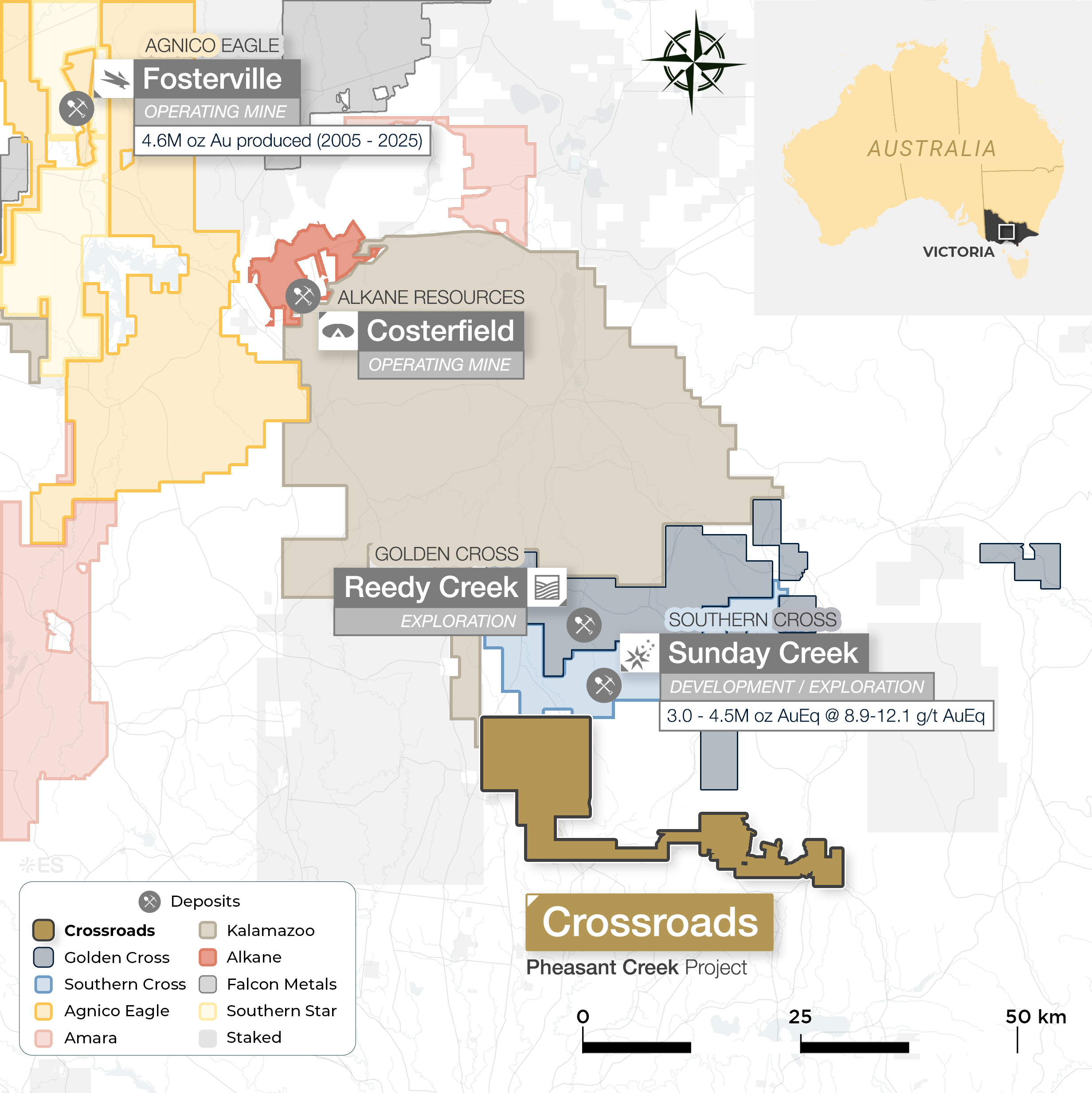
Regional claims map of central Victoria showing Crossroads’ Pheasant Creek Project just south of Southern Cross’ Sunday Creek and Golden Cross’ Reedy Creek, with Alkane’s Costerfield and Agnico Eagle’s Fosterville operating mines to the north, a claim-holder legend, an Australia locator inset and a 50 km scale bar

Figure 5: Regional Claims Map

Crossroads’ Pheasant Creek Project in relation to Agnico Eagle’s Fosterville, Alkane Resources’ Costerfield, Golden Cross’ Reedy Creek and Southern Cross’ Sunday Creek.
View full size →
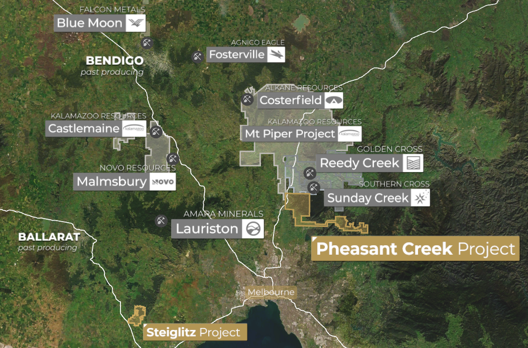
Satellite map of central Victoria showing the Pheasant Creek Project north of Melbourne and the Steiglitz Project to the south-west, with Bendigo, Ballarat and nearby projects including Fosterville, Costerfield, Mt Piper, Reedy Creek, Sunday Creek, Castlemaine, Malmsbury, Lauriston and Blue Moon

Figure 6: Regional Location Map

Pheasant Creek and Steiglitz Projects in relation to Bendigo, Ballarat, Melbourne and nearby mining projects.
View full size →
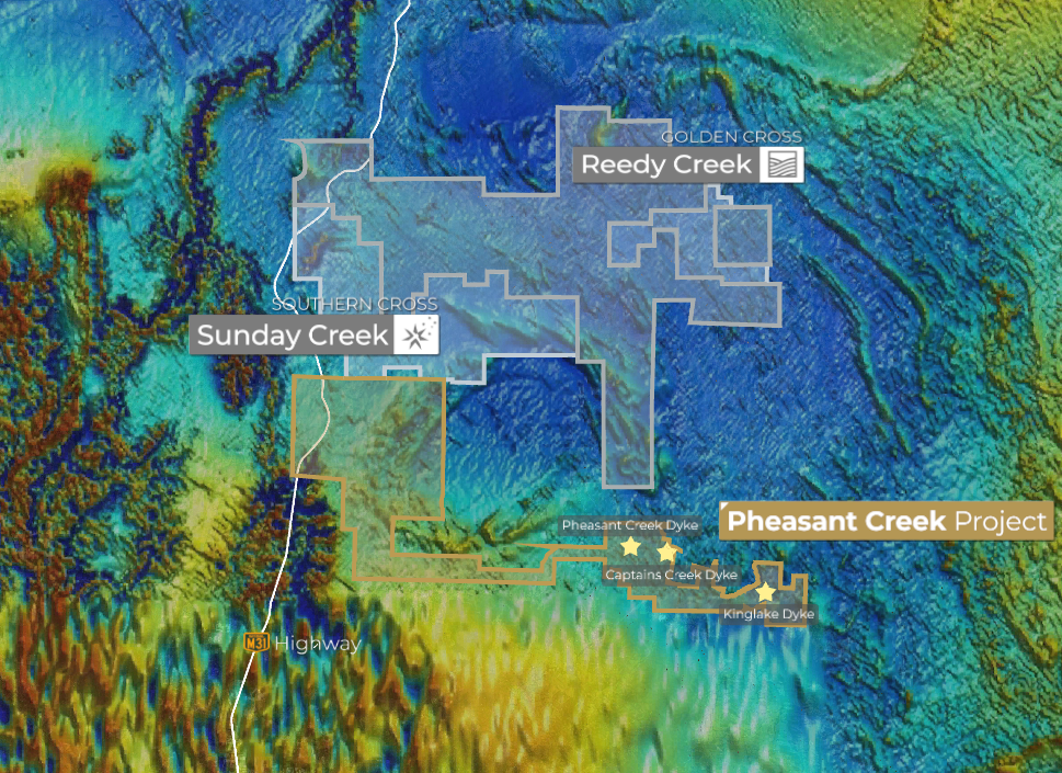
Colour elevation map of the Pheasant Creek Project area showing the project boundary south of Sunday Creek and Reedy Creek, with the Pheasant Creek, Captains Creek and Kinglake Dykes marked by stars and the M31 Highway to the west

Figure 7: Topographic / Elevation Map

Pheasant Creek Project area showing the Pheasant Creek, Captains Creek and Kinglake Dykes, adjacent to Sunday Creek and Reedy Creek.
View full size →
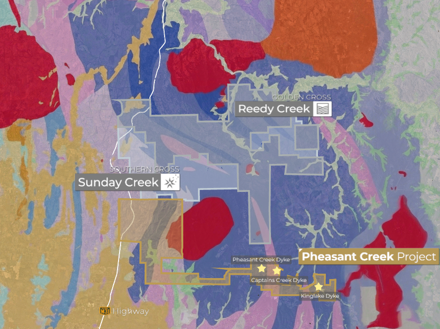
Geological map of the Pheasant Creek Project area showing colour-coded rock units, the project boundary south of Sunday Creek and Reedy Creek, and the Pheasant Creek, Captains Creek and Kinglake Dykes marked by stars

Figure 8: Geological Map

Geology of the Pheasant Creek Project area showing the Pheasant Creek, Captains Creek and Kinglake Dykes.
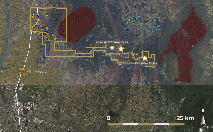
View full size →
Map of the Pheasant Creek Project area showing coloured sample location points within and around the project boundary, the Pheasant Creek, Captains Creek and Kinglake Dykes marked by stars, the M31 Highway and a 25 km scale bar

Figure 9: Sample Location Map

Pheasant Creek Project area showing sample locations and the Pheasant Creek, Captains Creek and Kinglake Dykes.

View full size →